Ivel Model Aircraft Club
  • Latest News
  • Events
  • Club Nights
  • CAA REGISTRATION
Picture
Ivel Model Aircraft Club
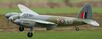
Model Aircraft Flying near Bedford UK
Our members are mainly from Bedfordshire and West Cambridgeshire


Picture
​
​CAA Registration:
(Updated 30 Mar 21)


17 Feb 21. — OPERATOR ID RENEWALS 2021.

The CAA should have sent all BMFA members their 19 digit Operator ID. If you do not have the email from the CAA check in your spam folder
​
For information about MANDATORY labeling of your model, Size/location etc, please look here:
https://register-drones.caa.co.uk/labelling-your-drone-or-model-aircraft


​​
CAA RULE CHANGES THAT CAME INTO EFFECT 1 JAN 21

All BMFA members should have had an email regarding changes to Article 16 requirements coming into effect 1 Jan 21. Essentially nothing much has changed to effect our flying. Follow the links applicable to our flying. A copy of the details in the email can be found here:

https://mailchi.mp/045f37696d1f/update-on-new-uk-drone-and-model-aircraft-rules-and-registration-renewals?e=55556ecf7a​

I understand from a BMFA Q&A webinar March 2021, that this document will continue to evolve over time.


​

Restrictions announced 20 February 2019

For all Drone/UAS (affecting all our model types) flying at or near listed airfields operating full size aircraft.
​These regulations came into effect wef:
13 March 2019
Airfield (full size) restrictions:

​On 13 March 2019 the drone flight restriction zone (FRZ) around airports and airfields changes.
The government has introduced a new rule stating that the 1km restriction from the airfield boundary is replaced by a restriction using the airfield’s existing aerodrome traffic zone, which has a radius of either, 2, or 2.5 nautical miles and then, five kilometres by one kilometre zones starting from the point known as the ‘threshold’ at the end of each of the airfield’s runways. Both zones extend upwards to a height of 2,000 feet above the airfield.
​
It is illegal to fly any drone at any time within these restricted zones unless you have permission from air traffic control at the airport or, if air traffic control is not operational, from the airport itself.

A link to a map showing each UK airfield’s FRZ restriction is available at:
dronesafe.uk/restrictions/
Also, the map can be added to Google maps on your PC/Phone/Mobile Device, as a layer extension.
www.google.com/maps/d/viewer?hl=en&mid=1z96X9CEZJzbdN8oIoDueKgyZ1rhBp2qj&ll=55.21850437057059%2C-3.171403000000055&z=5
Then it can be found on your PC/Phone/Mobile Device, at:
Menu:
Your Places:
Maps:
FRZ Runway Extension Zones:

NOTAM information can be found at:
notaminfo.com/ukmap
scroll down to the map which you can then scroll/move around the map, and zoom in and out,
and it is clickable on zones for additional information.
You may notice that we do have a NOTAM in place for Wilden and our Macca site.


​
​Back to main Ivel MAC website


​..
​
Powered by Create your own unique website with customizable templates.
  • Latest News
  • Events
  • Club Nights
  • CAA REGISTRATION